Hurricane season
Just these days, Hurricane Lee has formed, rapidly evolving from a category 3 to a category 4 hurricane

Just these days, Hurricane Lee has formed, rapidly evolving from a category 3 to a category 4 hurricane
The weather deterioration at the end of August seemed to mark the end of the summer season, but instead we are still experiencing hot and sunny days in most of our country and they will continue throughout the entire weekend.
In the far Southern Italy, conditions appeared to be more disturbed due to the presence of a wide and deep low system moving from the Ionian Sea towards Libya. Its movement and cyclonic rotational winds closely resembled those of hurricanes in the distant Atlantic, though with less strength and size.
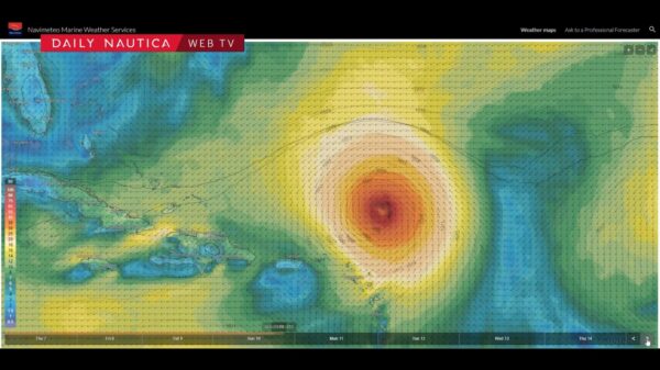
Speaking of hurricanes, we are in the midst of the season that causes the most concern in the Caribbean and Western Atlantic areas, often threatened by frequent tropical cyclones. Just these days, Hurricane Lee has formed, rapidly evolving from a category 3 to a category 4 hurricane.
This “monster” is currently located northeast of the Caribbean, moving northwest. However, its trajectory seems to spare Florida and the surrounding states, veering northward where it would lose intensity and downgrade to an extratropical storm by mid-month. Maximum alert is instead on the Bermuda Islands, which have already been hit by the tropical storm Idalia in recent days.
Finally, it is important to emphasize that technology has provided us with increasingly sophisticated tools to predict and monitor hurricanes, but without human intervention, we would not be able to effectively manage these threats. Knowledge of atmospheric dynamics and topography is crucial in order to predict and mitigate the effects of hurricanes.
Federico Brescia and Alberto Cantone
Video: Navimeteo Weather Panel – Evolution of hurricane LEE


