The mediterranean lows in autumn
Vuoi salvare articoli per un rapido accesso?
Sali a bordo della community DN Plus.
Per te, un'area riservata con: approfondimenti esclusivi, i tuoi articoli preferiti, contenuti personalizzati e altri vantaggi speciali
Accedi RegistratiThe first cold air masses of polar extraction coming down from the Balkans strongly contrast with the warm and humid air masses, which are lifted up by the central and eastern Mediterranean still very warm
The first cold air masses of polar extraction coming down from the Balkans strongly contrast with the warm and humid air masses, which are lifted up by the central and eastern Mediterranean still very warm
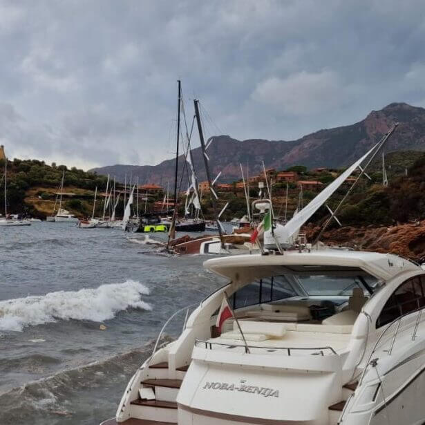
The grip of bad weather in the weekend has reached the heart of the Mediterranean, while at the beginning of the week a first disturbance battered Provence and the upper Tyrrhenian. When the throughs make so remarkable strikes up to Algeria and Tunisia, within these low pressure wedges new cyclonic circulation associated with dangerous thunderstorm lines, as we have seen in Sicily and Calabria in the last few days, and even before in the northern Italy.
The first cold air masses of polar extraction coming down from the Balkans strongly contrast with the warm and humid air masses, which are lifted up by the central and eastern Mediterranean still very warm: the energy involved is therefore sufficient to make these weather situations potentially critical on land and at sea.
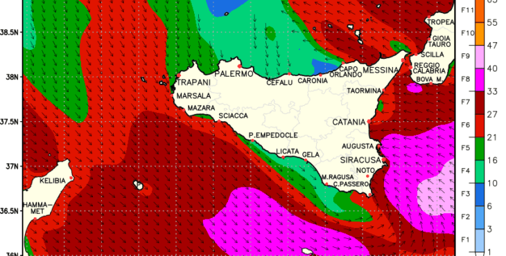
Wind (credit LAMMA)
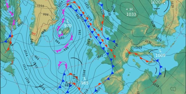
In these cases the synoptic maps always have a good didactic value. In the one I propose you can notice the curvature of the isobars (thin lines) around the low centered on Sicily and the warm and cold fronts (dark lines with semicircles and triangles).
The Mediterranean depressions, like that formed between Sicily and Sardinia, although small in size, bring often strong and sudden storms, as you can see from the attached wind forecast maps and wave motion. The real autumn has arrived for sailors too.
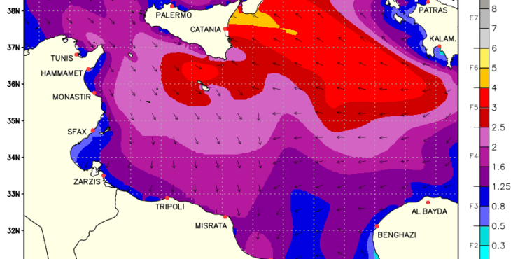
Waves (credit LAMMA)
Alessandro Casarino – Navimeteo
Topics: Navimeteo