Spring is here
Spring is characterized by the strong contrasts between the first warm calls from Africa and the powerful northern wind outbreaks

Spring is characterized by the strong contrasts between the first warm calls from Africa and the powerful northern wind outbreaks
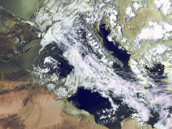
Now we can say that spring really has arrived on the Mediterranean. The season that takes us to the summer is characterized by the strong contrasts between the first warm calls from Africa and the powerful northern wind outbreaks, still possible until June on the Mediterranean.
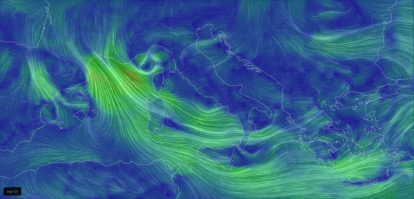
In these hours a thundery low is descending along the Tyrrhenian Sea, when it will be on the eastern Mediterranean towards Crete, a second minimum depressionary will deepen downwind the Alps, ready to follow the footsteps of the first low. The cold air masses arriving from N meet the Alpine range and are forced to split in two: a powerful Mistral wind blowing into the Mediterranean through the Rhone valley and an equally powerful Bora wind, that funnels through the Karst reliefs.
These are days when it is not surprising to read the word storm on the weather reports: storms more easily recall the ocean navigations, the coasts of Brittany, the banks of Newfoundland, however, those who cross our seas know well that from autumn to spring the disturbances coming from the Atlantic have the opportunity to cross the plains of France and enter the Mediterranean sweeping it with days of very strong winds: weather-marine situations that have nothing to envy to the stories of ocean navigators.
If you often study synoptic charts or weather models maps you have already noticed how in some perturbed days depressions seem to appear from nowhere in front of Provence: it’s not a mistake, that’s how this Mediterranean weather feature works.
The very high barrier offered by the Alps means that, at the pressing of the air masses from France towards Italy, the pressure field is modified with an increase the pressure windward of the mountain range and at the same time a deepening of a relative low downwind of it, depressions that then evolve in the following days moving eastwards. If there were no Alps, the disturbances coming from the ocean would not encounter any obstacle, continuing their course towards Greece, driven by the general circulation of the atmosphere.

Mistral wind – Credits: earth.nullschool.net
Alessandro Casarino – Navimeteo
Topics: Navimeteo


