The beginning of a stable period
Vuoi salvare articoli per un rapido accesso?
Sali a bordo della community DN Plus.
Per te, un'area riservata con: approfondimenti esclusivi, i tuoi articoli preferiti, contenuti personalizzati e altri vantaggi speciali
Accedi RegistratiStarting Monday, the 17th, we will enter a prolonged period of stable weather that could potentially last until March
Starting Monday, the 17th, we will enter a prolonged period of stable weather that could potentially last until March
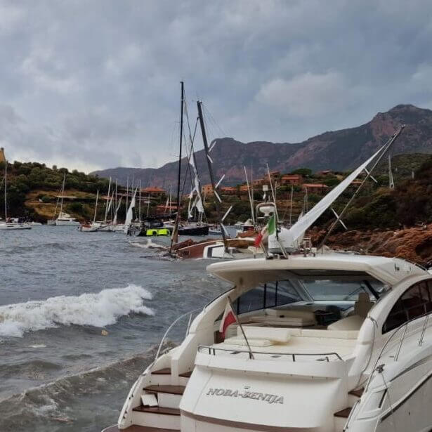
During the weekend, a low will rapidly move down the Tyrrhenian Sea, brushing across the entire Italian Peninsula from the Ligurian Sea to the Ionian Sea. Starting Monday, the 17th, we will enter a prolonged period of stable weather that could potentially last until March. However, weather models continue to present widely varying scenarios day by day, making it clear that uncertainty prevails in the long term.
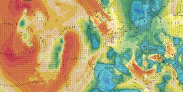
The Mediterranean low over the weekend should not be underestimated—it will deepen due to the clash between the advection of extremely cold northern air and the mild Scirocco air that has risen over the Mediterranean in recent days. Bora winds of 50 knots are expected in Trieste and the Quarnaro, while the Mistral will sweep from Provence to the Strait of Bonifacio.
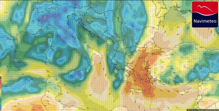
Looking at the weather charts for the upcoming week, what stands out is the potential development on Thursday, the 20th, when Italian waters will be dominated by a 1030 hPa anticyclonic ridge, bringing great stability, light winds and calm seas. Meanwhile, the Aegean and Eastern Mediterranean will be hit by an intense Meltemi, driven by the contrast with a deep low centered over Syria.
The Meltemi is a periodic wind that forms when high pressure strengthens west of the Peloponnese while a depression lingers east of the Cyclades. As you can see, this is not strictly a summer barometric pattern, despite what textbooks say—especially in these times of significant climate shifts.
In the first attached image, you can observe the vast circulation of the oceanic depression off Ireland and the small but intense low centered over the Tyrrhenian Sea. In the second image, the contrast is evident between Italy, without winds, and the severe storm raging over the Aegean.
Meltemi_20feb2025 (credit Navimeteo)
Casarino Alessandro – Navimeteo