
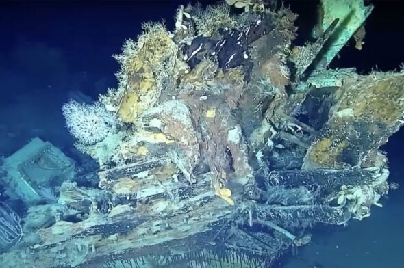
 At the Bottom of the Sea
Simple rules to understand the wind at sea
The wind is the true protagonist of the sea weather: the navigation conditions and the state of the sea depend on its strength and direction
The wind is the true protagonist of the sea weather. The navigation conditions, the state of the sea and wave heights, the difficulties of a mooring maneuver in port or anchoring in a bay depend on its strength and direction.
The character of the wind depends on its origin, there are gradient winds that blow over large areas and are determined by the pressure differences between two areas. The coastal breezes are determined, in good weather conditions, by the temperature differences, day and night, especially in summer, varying in direction and strength during the course of the day. Other wind types are generated by meteorological phenomena that can occur due to storms, blowing on the surface with strong gusts.
The air can travel on the surface of the sea or on the coasts or generate convective motions with the development of cumulus clouds or instability cells. Sometimes the winds can accelerate to storm force even in very small areas such as during the passage of waterspouts. The understanding of weather at sea is a vast and important topic to be explored and for this reason I have thought of summarizing some simple and elementary principles here in a very schematic and mnemonic way. Let’s follow them together using a practical method.
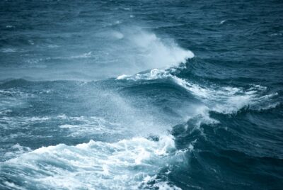
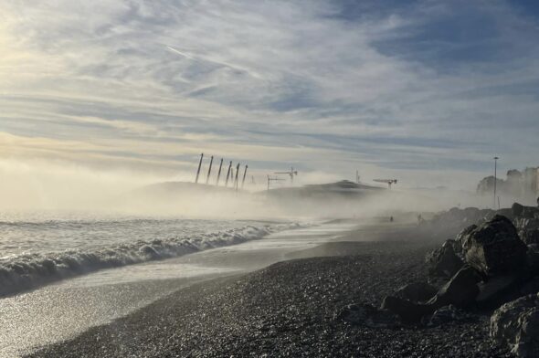
The force of the wind pulverizes the crests – Photo Credit Verstappen Photography
The weight of the air
Air has weight. Warm air is lighter. Cold air is heavier.
Convective motions
Warm, lighter air tends to rise. Cold, heavier air tends to sink.
Barometric variations
The different weight of the air determines the variations in atmospheric pressure. The changes in atmospheric pressure are measured by the barometer.
The isobars on the weather charts
Pressure values are indicated on weather maps by lines joining points of equal pressure called isobars.
Gradient winds and coastal breezes
Simplifying, there are two main types of winds on the surface of the sea:
– gradient winds, generated by pressure differences between two areas;
– coastal breezes, due to the different heating of the sea surface and of the coasts.
Day breezes and night breezes
Coastal breezes blow from the sea towards the coast during the day, reinforcing during the hottest hours. Instead, they blow from the coast towards the sea during the night.
The regular alternation of day and night breezes is an indicative sign of the persistence of good weather. The alternation between day and night breezes can break down as the weather worsens.
Where the wind blows
The wind always goes from high pressures (H) to low pressures (L). This happens in both the northern and southern hemisphere.
Baric gradient and weather charts
Gradient wind (due to pressure differences) is stronger with higher baric gradient.
On weather maps:
– far isobars, light wind or calm wind;
– nearby isobars, strong wind.
The Coriolis force
Due to the deviating Coriolis force induced by the rotation of the Earth:
– in the Northern hemisphere the flow of air masses flowing from High to Low Pressure is deflected to the right with respect to its own motion;
– in the Southern hemisphere the flow of air masses flowing from high to low pressure is deflected to the left with respect to its own motion.
The deflecting Coriolis force is maximum near the Poles and zero near the Equator.
How the wind rotates
In the Northern Hemisphere:
– the wind rotates and diverges clockwise in High Pressures (Anticyclones=H);
– the wind rotates and converges counterclockwise in Low Pressures (Depressions=L).
In the Southern Hemisphere:
– the wind rotates and diverges counterclockwise in High Pressures (Anticyclones=H);
– the wind rotates and converges clockwise in Low Pressures (Depressions=L).
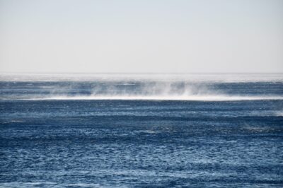
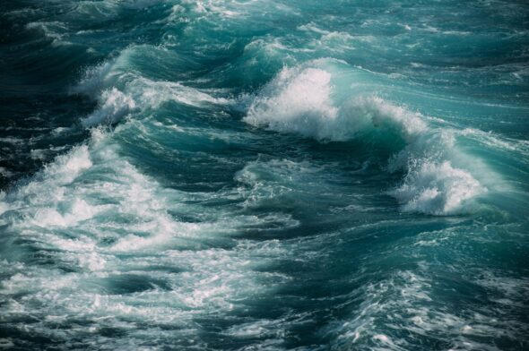
Strong gusts – Photo Credit Arno Senoner
Buys Ballot
In the northern hemisphere, out at sea, with the wind in front, the high pressure will be on our left (a little forward) and the low pressure on our right (a little behind).
In the southern hemisphere, out at sea, with the wind in front, the high pressure will be on our right (a little forward) and the low pressure on our left (a little behind).
The surface friction
It should be kept in mind that, in general, the wind on the ground is slowed down compared to the wind at high altitudes by friction with the earth’s surface, both at sea and on land. The wind at high altitudes is therefore stronger. The action of friction is greater on land and less on the sea.
The convergence effect
The wind that enters a strait or between two islands is accelerated with respect to the mean wind. It is a phenomenon analogous to that produced by the surface flow of sea currents, which reinforce in the straits.
The divergency effect
A wind that blows from land to sea is accelerated in the valleys and diverges when it reaches the sea, opening out like a folding fan.
The Beaufort Scale
The Beaufort scale indicates the wind strength from 0 (Calm) to 12 (Hurricane) and is used internationally in marine weather reports.
The wind direction
The direction of the wind refers to where it comes from, it can be expressed in degrees with respect to the North (from 0° to 360°) and can be indicated with respect to the cardinal points:
– a wind blowing dominantly from 45° is indicated as coming from the North-East (NE).
– a dominant wind blowing from 225° is indicated as coming from the South-West (SW).
The direction can also be expressed as a function of the quadrant from which the wind blows with respect to the 4 quadrants (for example, a wind from the 1st quadrant blows in the directions between N and E) or as a function of the dominant sector, as in the case of the winds northern, eastern, southern or western (for example, between SW and NW).
Naturally the winds can be indicated with their characteristic name compared to the wind rose that we all know (Mistral from NW, Scirocco from SE, Libeccio from SW, etc.).
The wind in the bulletins
The wind indicated in the forecasts of the marine weather bulletins is the average one.
The wind comes, the current goes
Contrary to the wind, the flow of the surface current “leads” towards the direction indicated by the current. A NW surface current of 1 knot “goes” NW and pushes a floating body in that direction.
Leeway and drift
The leeway is the lateral movement of the boat with respect to the bow due to the thrust of the wind.
Drift is the lateral movement of the boat with respect to the bow due to the thrust of the current.
The gust
Gust is a sudden and temporary reinforcement of mean wind speed due to flow instability or orographic turbulence effects.
The knot as a unit of measurement of the wind on the sea and of the speed of a boat
The force of the wind on the sea, most commonly expressed in knots (Kts): 1 knot = 1.852 km/h (kilometers per hour). The use of the knot is preferred since it refers to the nautical mile, the corresponding unit of measurement of distances at sea and since the speed of a boat is also expressed in knots. A boat traveling at an average speed of 12 knots will cover the distance of 12 Nautical Miles in one hour. To convert knots into Km/h, multiply the knots by two minus 10% (Km/h = Kts X 2-10% approximately).
Gianfranco Meggiorin

You might also be interested in
At the Bottom of the Sea
 Rose Island
The Greek island where people forget to die wants to become Austrian
The incredible story of Icaria, in the Aegean Sea, where the inhabitants’ favourite sport is waking up late in the morning
 Weather forecast
The Caligo, the fog of Genoa
Technically it is an advection sea fog, the kind of fog that condenses when a warmer and more humid air mass flows very slowly over the cold sea
 Weather forecast
Understanding the weather at sea: the most important thing? Two people talking to each other
The fundamental principles, what I like to call the rules of the weather alphabet and weather navigation, are always the same. Tools and techniques have evolved
 Weather forecast
A Mediterranean that changes its weather character
In recent years the Mediterranean has shown a new and in many ways unknown character
 Weather forecast
How ships escape the fury of hurricanes
How the world of cruise ships, yachting, maritime transport and ports coordinate to manage the criticalities that these phenomena can generate