Storm Éowyn will hit Scotland and Ireland hard
Vuoi salvare articoli per un rapido accesso?
Sali a bordo della community DN Plus.
Per te, un'area riservata con: approfondimenti esclusivi, i tuoi articoli preferiti, contenuti personalizzati e altri vantaggi speciali
Accedi RegistratiThe meteorological offices have issued a rare red alert, as winds of up to 190 km/h are foreseen
The meteorological offices have issued a rare red alert, as winds of up to 190 km/h are foreseen
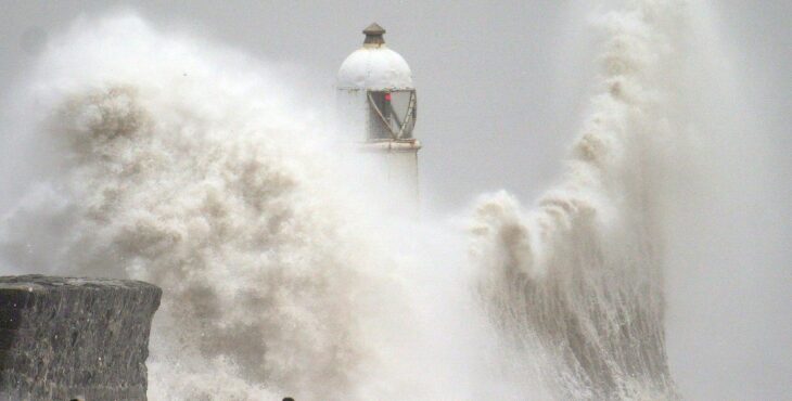
Storm Éowyn could be the storm of the century for Britain and Ireland, with winds reminiscent of those during Storm Debbie in 1961. As I write this, the UK Met Office and Met Éireann, the Irish Meteorological Service, are issuing their final warnings ahead of the storm’s arrival, expected on Friday, January 24th.
The meteorological offices have issued a rare red alert, as winds of up to 190 km/h are foreseen, equivalent to Category 3 on the Saffir-Simpson hurricane scale. These winds are expected to cause significant damage to buildings, port infrastructure and roads, posing a serious threat to anyone caught outside during the storm.
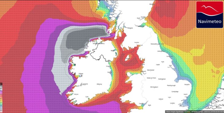
Wave Height 24jan (credit Navimeteo)
The storm will feature explosive cyclogenesis, with a rapid drop in pressure exceeding 40 hPa in just 24 hours. The system’s development is due to a powerful jet stream originating from the United States, following a recent incursion of Arctic air. This high-altitude “river of air” propels and intensifies disturbances from west to east across the Atlantic Ocean.
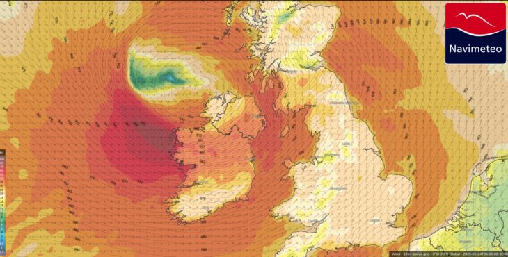
Wind 24jan (credit Navimeteo)
Storm Éowyn is the fifth named storm of the 2024/25 season. Storms are named when they are forecast to have medium to high intensity. Wind strength is the primary parameter considered when defining a storm’s intensity, however, the impact of wave action on the coast must also be carefully evaluated.
From the NOAA forecast map attached, you can see that significant wave heights may reach up to 12 meters, which implies potential maximum waves of 18–20 meters.
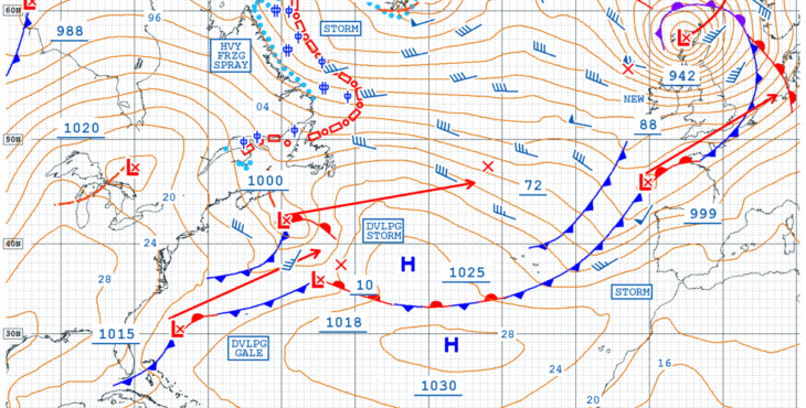
NOAA surface forecast (credit NOAA)
Casarino Alessandro – Navimeteo